🇦🇹
Best hikes in Eastern Austria

Nature in Austria is beautiful, so if you just want to get out, take a walk, and explore, it doesn't really matter where you go. However, if you are looking for the best views and challenging routes, this itinerary is for you. Also, all of the following places are only around an hour's drive from Vienna.
💡 General recommendations:
✔︎ Gear: Good hiking shoes, layered clothing based on the weather forecast and season, fully charged mobile phone, and sufficient water and snacks.
✔︎ Safety: Check weather forecasts, start early to avoid afternoon storms, and inform someone about your hiking plans.
✔︎ Navigation: Austrian trails are marked well, but detailed maps are important; consider downloading offline maps to your mobile phone.
✔︎ Insurance: Buy insurance for mountains, you never know when you may need professional help. Alpenverein is recommended, but it takes some time to receive a membership card. Make sure it's valid when you start the trip.
Schneeberg
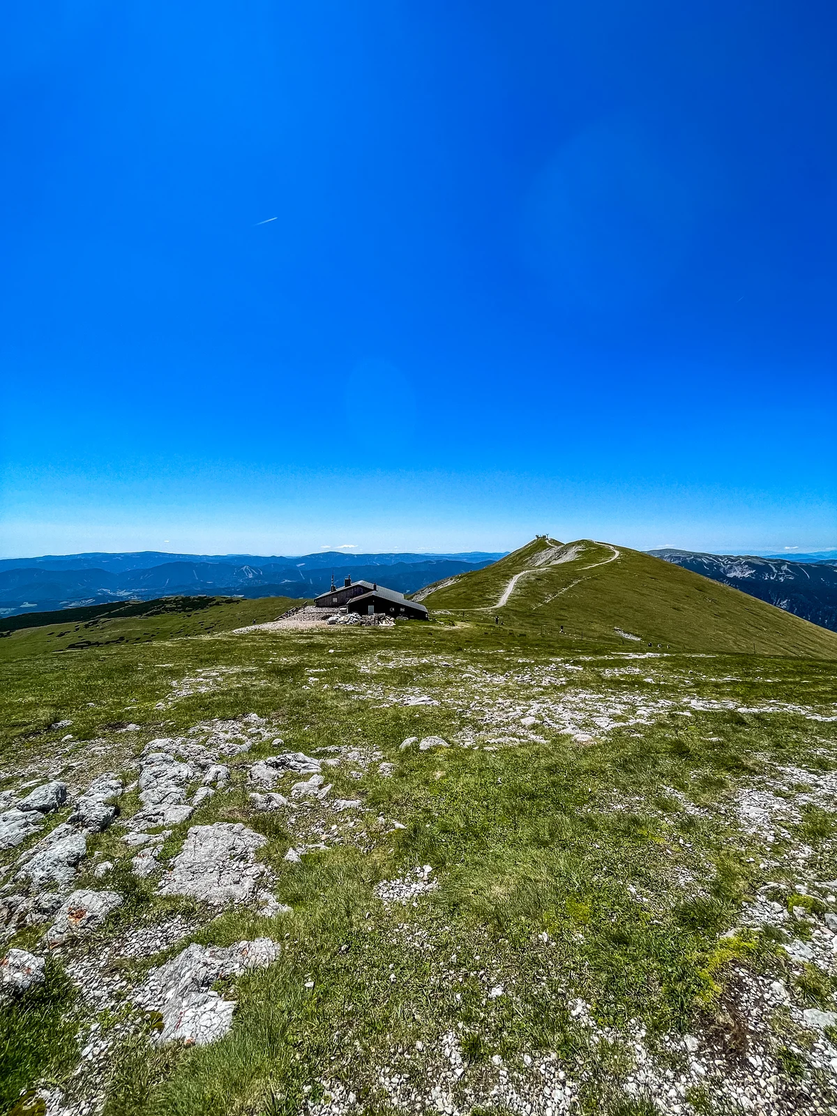
Schneeberg is the easternmost and highest mountain in the Northern Limestone Alps with a height of 2,076 meters. The hike offers beautiful panoramic views of the Viennese Basin and the Rax-Schneeberg Group. There is a mountain hut on the top so you can get some food and take a rest before your journey back.
Route type: Circle,
Distance: 18 km,
Elevation gain: 1377 m,
Difficulty: Moderate to challenging,
Best Time to Hike: June to September,
Trailhead: Puchberg am Schneeberg, parking lot near the ski center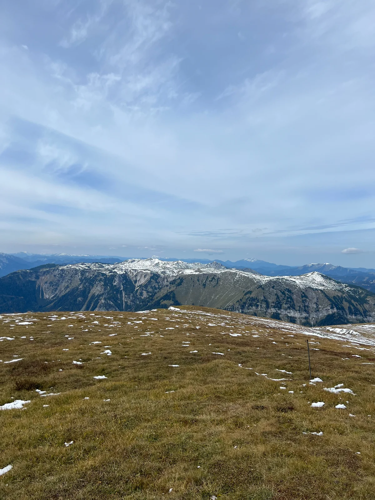
Heukuppe
The Heukuppe (2007 meters) is the highest peak of the Rax massif, offering expansive views over the plateau. Multiple mountain huts like the Karl Ludwig Haus provide rest stops and shelter.
Route type: Out and back,
Distance: 12 km,
Elevation gain: 907 m,
Difficulty: Moderate,
Best Time to Hike: June to October,
Trailhead: Preiner Gscheid or Hinternaßwald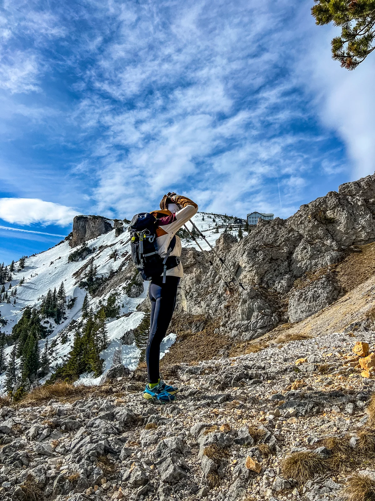
Ottohaus
Ottohaus (1644 meters) was built in 1893 and is a popular destination for hikers. The place offers spectacular views of the surrounding Rax-Schneeberg Group and the Vienna Basin. It is easily accessible via the Raxseilbahn, making it suitable for family hikes, but if you want to enjoy the full hike on your feet, we recommend the trail route from Knappenberg.
Route type: Out and back,
Distance: 13 km,
Elevation gain: 1083 m,
Difficulty: Easy to moderate,
Best Time to Hike: April to October,
Trailhead: Knappenberg
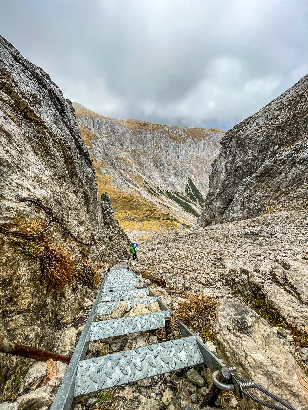
Hochswab
The Hochschwab massif is known for its many springs and is a significant water reservoir for the region. The hike to the summit of Hochschwab is rewarding with stunning panoramic views of the Alps. Bear in mind that the hike is challenging technically too, due to the terrain. The most difficult part of the hike is Das G´hackte - long stairs and steep rocks secured with chains. It is doable without ferrata equipment, but still be careful.
Route type: Circle,
Distance: 21 km,
Elevation gain: 1505 m,
Difficulty: Challenging,
Best Time to Hike: June to October,
Trailhead: Bodenbauer (parking lot near the guesthouse)


